
Google smart cities represent coordinated digital infrastructure platforms that integrate sensors, data analytics, and cloud computing to optimize municipal services, from traffic management and energy grids to waste collection and public safety systems. Rather than a single product, Google’s approach combines technologies like Google Cloud IoT, AI-driven analytics, and collaborative tools to help cities collect, process, and act on real-time urban data.
For Canadian municipalities facing the distinctive challenges of climate extremes, vast geographic spread, and diverse population densities, understanding how these platforms scale beyond pilot projects in major metros has become essential. While Toronto’s Quayside project famously stalled in 2020 amid privacy concerns and economic pressures, the underlying technologies have matured and dispersed into more focused, modular deployments across Canadian cities. By 2026, the conversation has shifted from all-encompassing smart districts to targeted infrastructure improvements that municipalities can implement incrementally.
This article examines the technical architecture behind Google’s smart city technologies, how they function within Canadian regulatory frameworks, and the practical considerations for scaling implementations from proof-of-concept to city-wide systems. Decision-makers will find data-driven analysis of deployment models, cost structures, and collaborative approaches that have succeeded in communities ranging from Vancouver to Halifax. The focus remains on extracting actionable guidance from real-world implementations, privacy-preserving design patterns, and interoperability standards that enable Canadian municipalities to adopt smart infrastructure without vendor lock-in or compromising citizen trust.
What Google Smart Cities Mean for Urban Development
Google smart cities represent urban environments that integrate Google’s suite of cloud computing, artificial intelligence, and data analytics technologies to transform how municipalities deliver services, manage resources, and engage with residents. Rather than a single product, this approach combines Google Cloud Platform infrastructure with AI-powered tools, Internet of Things connectivity, and real-time analytics to create responsive, data-driven cities that can adapt to changing conditions and citizen needs.
At their core, these implementations turn physical urban infrastructure into digitally connected systems. Sensors embedded in roads, buildings, transit vehicles, and public spaces generate continuous streams of data. Google’s cloud services process this information at scale, applying machine learning algorithms to identify patterns, forecast demand, and automate decisions that would overwhelm human operators. A traffic management system might analyze vehicle flow across hundreds of intersections simultaneously, adjusting signal timing to reduce congestion. An energy grid could predict consumption spikes and shift loads before brownouts occur.
- Cloud Infrastructure
- Scalable computing and storage resources hosted in Google’s data centres that eliminate the need for cities to build and maintain their own server farms. This enables municipalities to start small and expand capacity as needs grow.
- Digital Twin
- A virtual replica of physical city systems that runs simulations and tests scenarios before implementing changes in the real world, reducing risk and cost of urban planning decisions.
- Sensor Networks
- Arrays of connected devices measuring everything from air quality to pedestrian traffic, generating the raw data that powers smart city applications and decision-making.
- Urban OS
- An operating system layer that integrates data from disparate municipal systems into a unified platform, allowing different departments to share information and coordinate responses.
- Data Lakes
- Centralized repositories that store massive volumes of structured and unstructured urban data in its native format, making it accessible for analysis without requiring extensive pre-processing.
What distinguishes Google’s approach from other smart city vendors is the depth of its AI capabilities and the maturity of its cloud ecosystem. While competitors may offer specialized solutions for specific challenges, Google provides a comprehensive platform that municipal IT teams already know from consumer applications. The same natural language processing behind search can power citizen service chatbots. Computer vision models trained on billions of images can analyze traffic cameras or detect infrastructure damage. This translates complex technology into practical tools that cities can deploy without building expertise from scratch.
How Google Smart City Technology Works

Data Collection and Integration Layer
The data collection layer forms the physical foundation of Google’s smart city ecosystem, consisting of a distributed network of IoT sensors, environmental monitors, traffic cameras, and edge devices that continuously capture urban activity. These devices track vehicle movements at intersections, measure air quality indices in high-traffic corridors, monitor waste container fill levels, record energy consumption patterns across municipal buildings, and detect water pressure fluctuations in distribution networks. Google’s approach emphasizes standardized data formats based on open protocols and the NIST interoperability foundations that enable different device manufacturers and legacy systems to communicate through common APIs.
The integration framework aggregates streams from disparate sources into a unified data fabric, normalizing timestamps, geographic coordinates, and measurement units to create a coherent operational picture. Edge computing nodes perform initial data filtering and compression at collection points, reducing bandwidth demands while ensuring low-latency responses for time-sensitive applications like traffic signal adjustments. This architecture allows municipalities to start with targeted deployments in specific service areas and progressively expand coverage without replacing existing infrastructure, addressing the phased implementation requirements common to Canadian cities with varied budgets and technical capacities.
Analytics and Intelligence Layer
The analytics and intelligence layer transforms raw sensor data into actionable urban intelligence through Google Cloud’s AI and machine learning infrastructure. This processing tier ingests continuous streams from thousands of distributed sensors, traffic cameras, environmental monitors, utility meters, transit systems, and applies advanced algorithms to detect patterns invisible to human operators.
Google Cloud’s BigQuery handles petabyte-scale data warehousing, enabling cities to query years of historical data alongside real-time feeds within seconds. Machine learning models trained on this combined dataset identify recurring congestion patterns, predict equipment failures before they occur, and forecast demand spikes across utilities and services. For traffic optimization, algorithms analyze vehicle flow, pedestrian movement, and transit schedules simultaneously to generate timing adjustments that reduce delays by 15-30% during peak periods.
Predictive analytics prove particularly valuable for infrastructure management. Energy consumption models anticipate grid stress points hours in advance, allowing utilities to balance loads proactively rather than react to outages. Public safety applications use pattern recognition to identify crime hotspots and predict emergency call volumes, enabling better resource allocation across shifts and districts.
The intelligence layer’s continuous learning capability means these systems improve accuracy over time as they process more municipal data, adapting recommendations to local conditions rather than applying generic solutions.
Application and Service Delivery Layer
The application and service delivery layer translates data insights into tangible improvements for residents and city operations. Citizen-facing mobile apps provide real-time transit arrivals, parking availability, and service request tracking through intuitive interfaces powered by Google Maps Platform and Cloud APIs. Municipal dashboards aggregate operational metrics, traffic congestion levels, energy consumption patterns, waste collection routes, enabling administrators to make rapid, evidence-based decisions. Automated systems trigger actions without human intervention: traffic signals adjust timing based on current flow, streetlights dim during low-activity periods to save energy, and maintenance crews receive alerts when sensors detect infrastructure failures before they escalate. These applications close the loop between data collection and real-world outcomes, delivering measurable improvements in service reliability, resource efficiency, and resident satisfaction.
Core Components of Google’s Smart City Architecture
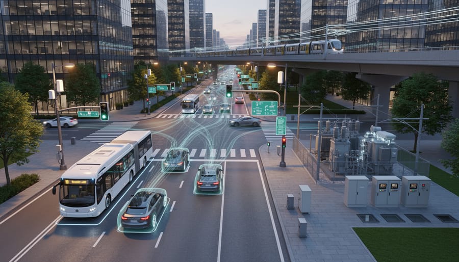
Google’s smart city architecture consists of interconnected cloud services and infrastructure components that work together to collect, process, and act on urban data at massive scale. Rather than requiring cities to build proprietary systems from scratch, this modular approach lets municipalities select and integrate the specific capabilities they need while maintaining flexibility to expand over time.
At the foundation sits the infrastructure management layer, which handles the enormous volume of connected devices deployed across a city. Google Cloud IoT Core manages device connectivity, authentication, and data ingestion from thousands or millions of sensors simultaneously. This managed service eliminates the need for cities to build custom device management infrastructure, automatically handling protocol translations, connection security, and real-time data streaming from heterogeneous sensor networks spanning traffic cameras, environmental monitors, utility meters, and public WiFi access points.
The data processing and storage layer transforms raw sensor feeds into structured information that analytics tools can query. BigQuery serves as the central data warehouse, capable of storing petabytes of historical and real-time urban data while executing complex queries in seconds. This capability proves essential for Canadian cities analyzing years of seasonal patterns or comparing performance metrics across multiple departments. Cloud Storage provides cost-effective archival for video footage, historical records, and backup datasets that municipalities must retain for compliance purposes.
The intelligence layer applies machine learning and spatial analytics to extract actionable insights from urban data:
- Google Cloud IoT Core for device management and secure sensor connectivity
- BigQuery for data warehousing and rapid analysis of massive urban datasets
- AI Platform for building and deploying predictive models for traffic, energy, and public safety
- Google Maps Platform for spatial intelligence, geocoding, and visualization
- Anthos for hybrid cloud deployment across on-premises and cloud infrastructure
- Security and privacy controls including encryption, access management, and audit logging
The integration and orchestration layer ties these components together through APIs and workflow automation tools. Cloud Functions enable cities to build event-driven responses, like automatically alerting maintenance crews when sensor data indicates infrastructure failures. Pub/Sub messaging ensures reliable communication between services even during high-load events like major civic gatherings or emergencies.
Security permeates every architectural layer rather than existing as a separate component. Identity and Access Management controls which city employees and systems can access specific datasets. VPC Service Controls create security perimeters around sensitive municipal data. All data flows through encrypted channels, and comprehensive audit logs track every access and modification for accountability.
Applications Across Municipal Services
Transportation and Mobility Management
Google’s smart city platforms transform urban transportation through integrated data systems that connect sensors, cameras, transit vehicles, and mobile devices across the entire mobility network. Traffic flow optimization relies on real-time analytics that process signal timing, vehicle counts, and incident data to reduce congestion by 15-30% in pilot deployments. Cities use these insights to dynamically adjust signal patterns during peak hours and route emergency vehicles along the fastest paths.
Public transit gains efficiency through passenger counting sensors, GPS tracking, and arrival prediction algorithms that improve schedule adherence and reduce wait times. Predictive maintenance models analyze vehicle telemetry to flag potential breakdowns before they cause service disruptions, cutting unplanned downtime by up to 25%. Parking management systems combine occupancy sensors with demand pricing to guide drivers to available spots, decreasing search time and emissions in downtown cores.
Multimodal trip planning integrates transit schedules, bike-share availability, ride-hailing options, and walking routes into unified journey recommendations. This coordination supports policy goals like reducing single-occupancy vehicle trips while giving residents reliable alternatives tailored to their actual travel patterns and preferences.
Energy and Environmental Sustainability
Google’s environmental intelligence platforms enable cities to monitor and optimize energy consumption across municipal infrastructure in real time. Smart grid management systems process data from distributed sensors to balance electricity loads, integrate renewable sources, and prevent outages before they occur. Building energy optimization tools analyze HVAC performance, lighting patterns, and occupancy data to reduce consumption by 20-30% while maintaining comfort standards.
Air quality monitoring networks combine satellite imagery, ground-level sensors, and weather data to create hyperlocal pollution maps. These systems identify emission hotspots, track particulate matter concentrations, and provide public health alerts during poor air quality events. Transportation departments use this intelligence to adjust traffic patterns and reduce vehicle congestion in sensitive areas.
Emissions reduction strategies leverage predictive analytics to forecast energy demand and optimize renewable energy deployment. Google’s Environmental Insights Explorer aggregates building energy data, transportation emissions, and urban forestry metrics into a unified dashboard. Cities use these tools to model policy scenarios, track progress toward climate commitments, and prioritize infrastructure investments that deliver measurable sustainability outcomes while managing operational costs.
Public Safety and Emergency Response
Google’s AI-powered situational awareness platforms transform how cities detect, respond to, and recover from public safety incidents. Video analytics deployed across municipal camera networks automatically identify anomalies, abandoned packages, crowd formations, or unusual traffic patterns, and alert operators in real time, reducing response times from minutes to seconds. Predictive policing algorithms analyze historical crime data, weather patterns, and event schedules to forecast high-risk locations, allowing strategic resource deployment before incidents occur. During emergencies, Google Cloud’s coordination tools aggregate data from 911 systems, field responders, hospitals, and traffic sensors into unified command dashboards, enabling faster triage decisions. Disaster response planning benefits from scenario modeling that simulates evacuation routes, shelter capacity, and infrastructure vulnerabilities under various crisis conditions, helping Canadian municipalities prepare for floods, wildfires, and extreme weather events with evidence-based contingency plans.
Citizen Services and Engagement
Google’s smart city platforms transform how residents access government services through AI-powered digital portals that understand natural language requests. Instead of navigating complex municipal websites, citizens can type or speak questions like “When is my next garbage pickup?” or “How do I apply for a building permit?” and receive instant, personalized responses. Enhanced 311 systems use machine learning to route inquiries automatically, predict service demand, and identify emerging issues before they escalate.
Participatory budgeting tools built on Google Cloud enable residents to propose projects, vote on priorities, and track spending in real time through interactive dashboards. These platforms analyze submission patterns to surface community needs and ensure equitable resource distribution across neighborhoods. Transparency dashboards visualize everything from pothole repairs to permit processing times, holding departments accountable while building public trust. For Canadian municipalities, these engagement tools prove particularly valuable in reaching diverse populations across urban and rural areas, with multilingual support and mobile-first designs that meet residents where they are.
Scalability Implications for Canadian Smart Cities
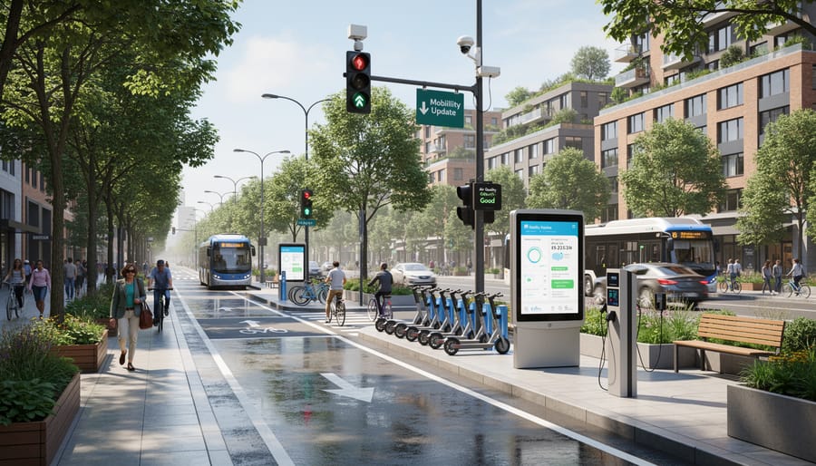
Canadian municipalities face a unique set of scalability challenges when implementing smart city technologies: vast geographic distances, extreme climate variability, diverse population densities ranging from rural townships to major metros, and budget constraints that demand solutions which scale affordably from proof-of-concept to citywide deployment. Google’s cloud-native architecture directly addresses these constraints through elastic infrastructure that expands or contracts based on actual usage rather than forcing municipalities to invest in fixed capacity upfront.
The pay-as-you-grow model proves particularly valuable for medium-sized Canadian cities testing smart mobility or environmental monitoring initiatives. A city of 150,000 residents can launch a traffic optimization pilot covering ten intersections, process only that data volume, then seamlessly expand to hundreds of nodes as results justify investment, without rearchitecting the underlying platform. This elasticity eliminates the traditional barrier where scaling required purchasing redundant server capacity or renegotiating vendor contracts.
Modular deployment architecture allows municipalities to implement specific capabilities without committing to comprehensive overhauls. A city might start with waste management sensors and analytics, add air quality monitoring six months later, then integrate transit optimization the following year, all building on the same data foundation and management interfaces. Each module operates independently yet shares common infrastructure, reducing complexity as systems grow.
Interoperability standards embedded in Google Cloud Platform enable collaboration across jurisdictions, critical in Canada where regional coordination can improve outcomes. Multiple municipalities can pool transportation data to optimize regional transit networks, share environmental monitoring insights across airshed boundaries, or coordinate emergency response systems, all while maintaining local control over their data and applications. The shared technical framework reduces integration costs that typically plague multi-jurisdiction initiatives.
Data sovereignty considerations matter significantly for Canadian public sector deployments. Google Cloud’s Toronto and Montreal regions provide infrastructure options that keep municipal data within Canadian borders, addressing regulatory requirements and public concerns about cross-border data flows. Cities can configure storage and processing to remain domestic while still accessing global AI and analytics capabilities, balancing compliance with functionality.
Smaller municipalities benefit from what larger cities have already validated. When Toronto or Vancouver proves a particular application works at scale, towns of 50,000 can adopt similar capabilities without bearing the full cost of experimentation. The cloud delivery model democratizes access to sophisticated urban intelligence that previously required resources only major metros could afford, narrowing the digital divide between urban and rural Canada.
Implementation Considerations and Best Practices
Successfully implementing Google smart city solutions requires strategic planning that addresses both technical infrastructure and organizational readiness. Canadian municipalities face unique challenges related to climate, geographic dispersion, and regulatory frameworks that demand careful consideration beyond technology selection alone.
The foundation of any successful deployment starts with a thorough assessment of existing municipal capabilities and clear articulation of outcomes. Cities should begin by identifying specific service delivery problems rather than pursuing technology for its own sake. A municipality struggling with winter road maintenance efficiency, for example, will benefit more from targeted sensor deployments and predictive analytics than from comprehensive smart city platforms that address problems it doesn’t face. This problem-first approach ensures investments deliver measurable value while building organizational confidence in digital transformation.
Procurement strategies must balance innovation with accountability. Traditional RFP processes often struggle to evaluate cloud-based solutions that evolve continuously, making outcome-based contracting more suitable than specifications-focused approaches. Municipalities should consider phased implementations that prove value in limited domains before scaling across departments. Pilot projects in single neighborhoods or service areas allow cities to test integration with legacy systems, validate data quality, and refine privacy protections before committing to broader deployments.
Critical implementation considerations include:
- Conducting comprehensive needs assessments that involve frontline staff, not just technology departments
- Establishing clear data governance policies that define ownership, access rights, and retention schedules before collecting the first byte
- Building internal technical capacity through training programs and strategic hires rather than relying entirely on vendor expertise
- Ensuring vendor lock-in mitigation strategies through open standards, data portability requirements, and modular architecture design
- Planning for long-term maintenance and upgrades with realistic budget forecasts that account for both platform fees and internal resources
- Engaging citizens in co-design processes to build trust and ensure solutions address actual community priorities
Privacy governance deserves particular attention given the sensitive nature of urban data streams. Municipalities should establish privacy impact assessment processes, appoint dedicated privacy officers, and create citizen advisory committees before deploying surveillance-capable technologies like video analytics or movement tracking systems. Transparency about what data gets collected, how it’s used, and who can access it builds public trust that purely technical solutions cannot achieve.
Partnership models offer pathways for smaller municipalities that lack resources for independent deployments. Regional collaborations allow cities to share infrastructure costs, pool technical expertise, and negotiate better terms with vendors. Technology research organizations across Canada provide neutral guidance on deployment strategies, helping municipalities avoid common pitfalls while adapting solutions to local contexts rather than importing implementations designed for different regulatory or geographic environments.
Common Questions About Google Smart Cities
What distinguishes Google’s smart city approach from other vendors?
Google’s platform emphasizes cloud-native scalability, advanced AI and machine learning capabilities, and integration with its existing suite of mapping, analytics, and collaboration tools. Unlike vendors offering proprietary hardware ecosystems, Google provides infrastructure-agnostic solutions that work with multiple sensor and device manufacturers, reducing vendor lock-in.
How do Canadian data sovereignty laws affect Google smart city deployments?
Canadian municipalities must ensure that citizen data remains within national borders and complies with federal and provincial privacy legislation. Google Cloud offers Canadian data residency options through its Montreal and Toronto regions, allowing cities to meet compliance requirements while leveraging cloud infrastructure.
What are typical implementation timelines and costs for Canadian cities?
Pilot implementations typically span six to twelve months, with full-scale deployments taking two to three years depending on municipal size and complexity. Costs vary widely based on scope, but smaller cities can start with focused applications at $200,000 to $500,000 annually, while comprehensive metropolitan deployments may require multi-million-dollar budgets.
How is citizen privacy protected in Google smart city systems?
Privacy protection relies on anonymization at the data collection layer, role-based access controls, encrypted transmission and storage, and governance frameworks that define permissible uses. Canadian municipalities must establish independent privacy oversight bodies and conduct regular impact assessments to maintain public trust.
Can smaller municipalities afford Google smart city solutions?
The cloud-based subscription model makes Google’s offerings accessible to smaller cities without massive upfront infrastructure investments. Municipalities can start with specific applications like traffic management or energy monitoring, then expand as they demonstrate value and secure additional funding.
What skills do municipal staff need to manage these systems?
Successful implementations require teams with data analytics capabilities, cloud platform knowledge, cybersecurity expertise, and project management experience. Many Canadian cities address skill gaps through partnerships with post-secondary institutions, technology research organizations, and workforce development programs that provide training and capacity building.
Beyond these common inquiries, municipal decision-makers should consider how vendor partnerships evolve over time. Smart city deployments are not one-time projects but ongoing relationships that require continuous adaptation as technologies mature and urban needs change. Establishing clear governance structures from the outset, including defined roles for technology partners, municipal staff, and citizen oversight committees, helps prevent confusion as systems scale and expand.
Procurement approaches matter significantly. Traditional RFP processes designed for discrete infrastructure purchases often fail to accommodate the iterative, agile nature of cloud-based smart city platforms. Forward-thinking municipalities are adopting more flexible contracting models that allow for phased implementations, technology pivots based on early results, and performance-based payment structures aligned with measurable outcomes rather than simple deliverables.
The question of interoperability deserves attention as well. Cities investing in Google’s ecosystem should ensure that data formats, APIs, and integration points follow open standards wherever possible. This prevents future migration headaches and allows municipalities to incorporate best-of-breed solutions from multiple vendors as the smart city landscape evolves. Smart contracts should include provisions for data portability and system integration with non-Google platforms to preserve municipal autonomy and negotiating power over time.
Google smart cities represent a proven technological foundation for addressing Canada’s unique urban development challenges, from vast geographic distances to diverse municipal capacities. The cloud-native architecture, AI-powered analytics, and standardized integration frameworks discussed throughout this article offer Canadian municipalities a pathway to modernize infrastructure without the capital intensity of traditional systems.
Success depends on more than technology selection. Strategic planning that aligns smart city investments with specific community needs, collaborative governance models that engage citizens and stakeholders from the outset, and deliberate capacity building within municipal teams form the essential prerequisites for realizing these systems’ full potential. Cities that treat digital infrastructure as a governance challenge, not merely a procurement exercise, consistently achieve better outcomes.
Privacy protections and regulatory compliance must remain foundational rather than afterthoughts. The frameworks established through Canada’s privacy legislation provide strong safeguards when properly implemented, but municipalities need internal expertise to navigate data governance, vendor agreements, and citizen rights effectively. Building this competency requires investment in people alongside technology.
The scalability advantages Google’s platforms offer matter most when municipalities approach implementation incrementally, learning from early deployments before expanding scope. Starting with well-defined use cases, measuring outcomes rigorously, and adjusting based on evidence creates sustainable smart city programs that earn public trust and deliver measurable improvements in urban life. Technology enables transformation, but leadership, collaboration, and thoughtful governance make it succeed.